
CIFRI Awards
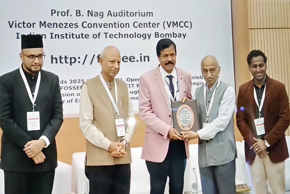
In a proud moment for the fisheries science community, the ICAR-Central Inland Fisheries Research Institute (ICAR-CIFRI), Barrackpore, has been awarded the National Geospatial Practitioner Award 2025 during the Open Source GIS Day celebrations at IIT Bombay. The award was presented to Dr B.K. Das, Director, ICAR-CIFRI, by Padma Shri Dr A.S. Kiran Kumar, former Chairman of ISRO at the Victor Menezes Convention Centre.
 The National Geospatial Awards, now in their second edition, are organized by the FOSSEE (GIS) project of IIT Bombay under the aegis of the National Mission on Education through ICT (NMEICT), Ministry of Education, Government of India. The awards aim to honour institutions and individuals advancing geospatial technology in India, particularly through open-source platforms in alignment with the National Geospatial Policy 2022 and Indian Space Policy 2023.
ICAR-CIFRI was recognized for its outstanding leadership and innovation in the integration of geospatial technologies in inland fisheries research and environmental monitoring. Over the past two decades, the Institute has transitioned from proprietary GIS systems to a fully open-source ecosystem, utilizing tools such as QGIS, R, Python, and Google Earth Engine (GEE).
Notable achievements include the semi-automated delineation of water bodies larger than 0.2 hectares using GEE, with data sourced from Sentinel-2 and LISS-IV satellites, combined with extensive field validation of fish catch and production data. Under the Namami Gange programme, the Institute has applied GIS tools to visualize and manage fisheries-related data for the Ganga River basin.
The Institute is also leading the way in drone-based mapping of small water bodies and submerged aquatic vegetation to improve productivity and manage aquatic weeds. Further advancing open science, ICAR-CIFRI has developed a national-level online geospatial system for inland fisheries using platforms like R-Shiny, GeoServer, and Linux Debian servers. Through its research, the Institute has mapped inland water bodies across 20 states and developed several digital tools, including the Water Body Information System. Its use of remote sensing for monitoring critical water quality parameters such as chlorophyll-a, temperature and pH reflects its strong commitment to technology-led environmental stewardship.
Cutting-edge geostatistical research at ICAR-CIFRI includes Bayesian kriging for fish species richness, residual kriging for plankton dynamics, and spatio-temporal models for reservoir water spread and Hilsa fisheries prediction in estuarine zones.
With over 50 research scholars engaged and hundreds of professionals and students trained through specialized programmes and two ICAR-sponsored Winter Schools, ICAR-CIFRI has emerged as a national leader in the application of open-source geospatial tools in fisheries science.
This prestigious recognition is a testament to ICAR-CIFRI’s impactful contributions and commitment to sustainable inland fisheries development through science, technology, and innovation.